Geographical position compared with the
district’s center:
Lam San commune is located in the southeast of Cam
My district’s center and is 30 km from the district’s center.
Natural land area:
The commune’s natural land area is 3,264.68 ha,
accounting for 6.97% of the district’s land area
Lam San borders on Song Ray commune, Cam My district
to the north.
Lam San borders on Son Binh and Binh Trung communes,
Chau Duc district, Ba Ria – Vung Tau province to the south.
Lam San borders on Quang Thanh commune, Chau Duc
district, Ba Ria – Vung Tau province to the west.
Lam San borders on Tan Lam commune, Xuyen Moc
district, Ba Ria - Vung Tau province to the east.
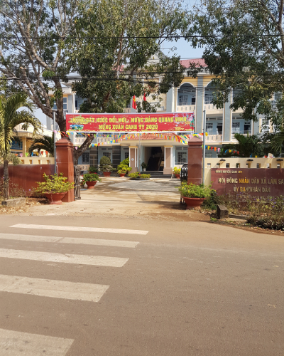
Administrative units:
Lam San commune is divided into 6 hamlets: 1, 2, 3,
4, 5, and 6.
Terrain:
The commune has a flat terrain with slope of 3-80
and an area of 1,784 ha, accounting for 54.64% of the total natural area, and
the area is currently planted with annual crops, cashew, coffee and other
perennial crops.
The slope terrain accounts for 42.94% of the entire
commune with the common slope of 80-150; due to a high slope, the level of water
retention is poor and it is easy for erosion to occur in the rainy season; and
the reality of land for planting perennial industrial crops like coffee and
cashew.
Climate:
The commune is located in a sub-equatorial tropical
climate with two distinct rainy and sunny seasons. The rainy season starts in
May and ends in late November and the sunny season starts in early December and
ends in late April.
The average temperature is 25.4 Celsius degrees.
The average rainfall is 1,956-2,139 mm/year.
Humidity: 85%.
Average temperature 25.5 Celsius degrees.
Highest temperature: 33 Celsius degrees.
Lowest temperature: 18 Celsius degrees.
Culture and history:
Time of establishment:
Lam San is a commune that was newly established in
1994 and it belonged to Xuan Loc district. In 2003, it belonged to Cam My
district, Dong Nai province but the land of Lam San has a long history. The name
and administrative boundary of Lam San commune have also changed according to
the national history and the land’s history.
During the war against the US in 1954-1975 period,
today’s Lam San commune and Song Ray are one of the revolutionary bases of Ba
Ria - Long Khanh province including such bases as Suoi The and Song Ray, where
the headquarters of the revolutionary headquarters of the Ba Ria - Long Khanh
Provincial Party Committee, the Long Khanh Provincial Party Committee, the Xuan
Loc District Party Committee and such army units as Battalion 445, the troop
units of the region and the area like Battalion 800, Regiment 4 at Division 5,
Field Hospital K76C, Logistics Unit 814 of the region, the provincial Security
Forces, and K8 troop unit of Xuan Loc district are. During the fight against the
US to liberate the country in 1954–1975 period. The Suoi The base in 1957-1972
period made significant contributions to the overall victory of the district,
the province, the region and the country.
Since the liberation in 1975, thousands of people
from parts of the country and ethnic minority groups across the country arrived
and settled here and worked in Song Ray plantation. Then, knowing about this
land of “Birds are perch in safe land”, people felt attached to this land and
settled here, and more and more people stayed to make villages and hamlets.
In 1994, the government issued Decree no. 109/ND-CP
on the separation of some communes in Xuan Loc district. Particularly, Lam San
commune was established on the basis of separating part of the land in today’s
Song Ray commune. Lam San commune’s Party Committee was established on the basis
of the Party Committee 7, directly under the Party Committee of Song Ray
commune.
In the past 20 years of construction and
development, the Party Committee, authorities and people of Lam San commune have
experienced many difficulties, obstacles and challenges but have overcome those
thanks to the leadership and close direction of the province and the district.
There is the solidarity from the Party Committee to local authorities and
people. Currently, Lam San commune is becoming richer and more beautiful and
emerging strongly with lots of progress in accordance with the country’s general
development pace of the country, the province and the district.
Over the past years, the Party Committee,
authorities and people of the commune have obtained a lot of achievements such
as
- 1 excellent emulation unit flag of the Prime
Minister
- 3 excellent emulation units flags of the
provincial People’s Committee.
- 11 certificates of merit from the provincial
People’s Committee.
+ The commune has 1 heroic Vietnamese mother, 12 war
invalids and 39 government policy beneficiary families and people with
meritorious services to the revolution.
Population:
Total population: 9,091 people.
Total number of households: 2,017.
Ethnic minority groups: there are 8 ethnic groups in
the commune: Kinh, Chinese Vietnamese, Tay, Nung, Khmer, Chau ro, San Diu, and
Cham including 224 ethnic minority households with 1,094 people, accounting for
12.03% of the population.
Religions: there are 4 religions with 2,024
followers, accounting for 22.26% of the commune’s population including 272
protestants, accounting for 2.99%; 1,042 Catholics, accounting for 11.46%; 700
Buddhists, accounting for 7.69%; and 10 Caodaists, accounting for 0.11%.