Workforce
The total number of households in the
commune: 4,230 families;
The number of people: 19,368 people;
The number of working age people: 10,949
people;
Industrial labor rate: 26.93 percent;
Agricultural
labor rate: 44.2 percent;
Trade-service labor rate: 28.87 percent;
Land
The total area of natural land:
4713.33 hectares; - Percentage: 100.00 percent
Agricultural land area: 4228.11 hectares
- Rate: 89.71 percent;
Forestry land area: 1470.07 hectares -
Rate: 31.19 percent;
Specialized land area: 242.51 hectares -
The rate of 5.15 percent;
Land area of 137.68 hectares –
percentage: 2.92 percent;
Land use: The total area of the
commune is mostly agricultural land, accounting for 89.71 percent of natural
area and non-agricultural land occupies 10.29 percent of natural land area.
Forest resources
Forest area: 1,470.07 hectares
Forest tree species: Melaleuca, hybrid
Acacia, nacre, Hopea, Jatropha curcas, etc.
Mineral resources
Types of minerals
in the commune: Nam Chau Son quarry
Location of the mineral
resources: Trung Tin Hamlet, Xuan Truong Commune
Exploitation status: Being
mined
Tourist attractions and historical
relics
Name of the scenic spot:
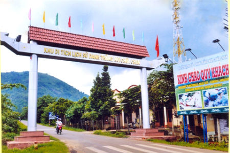
Chua Chan Mountain Historical-Scenic Site
Location: in the communes of Xuan Truong
and Xuan Tho, Xuan Loc, Dong Nai
About the scenic spot:
About 100 km from Ho Chi Minh City along Highway 1A to Hanoi, Chua Chan mountain
looks like a majestic pavilion at the altitude of over
800 meters. This is a less freequently seen mountain in
Southern Region, a charming landscape located in Xuan Loc
district and surrounded by the Xuan Truong, Xuan Tho and Xuan Hiep communes
today. This is a "sweet breast"
with abundant resources to feed generations of Chau Ro, Cham and Vietnamese
people who came here and set up their own villages. In the past Xuan Loc in
general and Chua Chan mountain in particular was a buffer between Cham Pa and
Chan Lap kingdoms. Some ethnic groups of Chau Ro and Stieng from the Central
Highlands also came to settle here. They made their livings mainly by hunting
small animals and gathering forest fruits. But food supply dried up over the
years, and the people had to clear the forest for rice and corn cultivation,
creating the shifting cultivation life around Chua Chan mountain. Alongside the
ravines, villages gradually appeared amid the jungle. The image of flickering
fire during the night showed human life and existence in the pristine time of a
wilderness. But the local climatic and territorial characteristics are very
unfavorable. native population has
less grown; by the early 20th century people in the Southeast called the area
"Ma Thien Lanh" with nebulous atmosphere. According to ethnographical records,
there had been a yellow fever epidemic that swept out a
whole village. There were only a few survivors and they managed to move to
another land to clear forest for cultivation and set up shelters. Hunger and
chronic illness had persisted generation to generation. It was not until the
triumph of August 1945 Revolution that the life of the indigenous people around
Chua Chan Mountain gradually improved, the enlightening of culture began to
transform far-flung villages. Experiencing historical changes during the
ancestral land expansion, Chua Chan Mountain is perhaps a milestone on the
Southward expedition path. Stories tell that the Nguyen Lords and Princess Ngoc
Van had arrived in this land.
Tourist Services: According to the
statistics of the Management Board of Chua Chan Mountain Historical-Scenic Site,
since the first day of the Lunar New Year, this site has welcomed more than
50,000 visitors worshiping Buddha. Particularly on the 4th and 5th days of the
Lunar New Year, the number of visitors has surged to nearly 10-13 thousand
people a day. According to the board, the number of arrivals will continue to
increase on the 14th and the 15th days of the first lunar
month. It is known that the Chua Chan Mountain Historical-Scenic Site is a
highlight of Dong Nai tourism industry. To fully take
advantage of this type of business, Xuan Loc has proposed many strategies in
planning the overall area of Chua Chan mountain, such as: embellishing the Bao
Dai Tea Garden, and establishing the zoos, resorts, water parks and other forms
of entertainment. Chua Chan Mountain Historical-Scenic Site is apparently
becoming an ideal destination for visitors.
Development orientation of Chua Chan
Mountain Historical-Scenic Complex in future:
Chua Chan Mountain Historical-Scenic
Site holds great value of culture, and history, nature and science,
and great potential for tourist development and
traditional craft industries. To effectively manage and make
full use of this, it is necessary to find out a comprehensive and long-lived
development strategy.
* Orientation of landscape
and architectural space
arrangement:
According to the master plan, Chua Chan
Mountain Historical-Scenic Site is defined as a spiritual, historical and
ecological scenic spot. The scale of planned area is 250 ha. However; as being
located inside the reforestation area protecting Chua Chan Mountain (1,739 ha),
it is necessary to comply with the protection forrest regulations. All the
available natural landscapes need to be kept intact.
While doing
planning, in addition to the preservation of national-listed architectural
structures, streams, caverns and old trees should be conserved.
Constructions that would be newly built are only simply designed
rest-stops blended with natural surroundings. To take advantage of surrounding
landscapes while visitors going sightseeing, the rest-stops
should be located in places with nice landscapes and good views so that
in addition to sight-seeing, visitors can also enjoy
locally specified products (in order to help develop local handicraft and forest
product processing industries).
The planned location is characterized by
highly steep terrains, so it is
unsuitable for entertainment forms such as horse riding, motor racing and
hiking, etc. The most feasible forms of amusement are
walking for sight-seeing, visiting pagoda and exploring caverns or visiting Hinh
Tunnel and Bao Dai Tea Garden, and so on. This is why
when doing planning it is necessary to make roads blend with
the terrain features and not destroy the natural
landscapes but instead, to take advantage of the abundance of
natural sights to amuse visitors during the trip. Decoration trees and
bonsai are grown and interlaced with forest trees to make the
landscapes more attractive.
Cable car system is
available for visitors who do not want to walk to enjoy sight-seeing from above.
The safety buffer space of cable cars is equipped with poetic designs, combing
streams and rivers with rocks and trees to create a beautiful match. When
stepping out of the cable cars to the rest-stops visitors can join the flock of
walkers to continue their nature expedition trip.
For Zone I:
- Structures designated
for spiritual tourism development including Bao Quang
Pagoda, Lam Son Pagoda and Linh Son Pagoda of which parts have degraded over
time will be preserved, repaired and restored.
- Hinh Tunnel
Secret Zone: will be preserved as orginal state,
and restored, reviving daily life activties of cadres and
soldiers during the French Resistance War (via artifacts,
pictures, wax figures, and so forth); the
areas surrounding extra structures will be expanded for
creating favorable conditons for history tourism.
- Bao Dai Tea Garden:
The Bao Dai Tea Garden has been almost vanished, with only
several trees left, so it is necessary to conduct strict protection measures as
for a cultural heritage. It should be considered to re-plant tea trees to
attract tourists and combine with eco-tourism.
- French
Governor-General guesthouse: It is now
designated as a military zone (the
Military Zone 7 radar station) within the range of no
trespassing area, which needs to be marked as a relic.
- It is necessary to
conserve four streams springing from Chua Chan Mountain,
especially Tom Stream which is a nice stream for tourist attraction. Several
sections of carverns need to be preserved and cleared for adventure tourism
development. Also, some old trees need to be protected, including the 3-stem
Banyan tree.
For Zone II:
- It is necessary to
clarify the range and scale of functional sub-zones, newly developed zone and
conserved zone for future development, specifically,
architectural parts, landscape, rest-stops and
architectural design proposals;
- It is necessary to
determine traffic routes, power and water suppy networks in Zone I;
- With the approved
forestry planning a match should be created between the areas;
Functional sub-zones:
- Zone I: Spritual areas
include Buu Quang Pagoda,
Lam Son Pagoda and Linh Son Pagoda, with total area of 29
hectares;
- Zone II:
Historical area including Hinh Tunnel cave,
Bao Dai Tea Garden, and French
Governor-General guesthouse, with total area of 9 hectares;
- Zone III:
Eco and exploration area
+ Caverns, 3-stem
Banyan tree, streams and rivers,
the whole area of green hills, with total area of 149.6
hectares;
+ Land for roads
+ sight-seeing rest-stops: 42.9
hectares.
+ Land for cable car
safety buffer space: 5.55 hectares.
+ Land for service,
parking lot, and souvenir store: 9.95
hectares.
Land use chart
| |
Types of
Land |
Area (ha) |
Percentage |
|
I |
Zone I
(Monument) |
42.00 |
16.8 |
|
1 |
Land for spiritual purpose |
|
|
|
|
Buu Quang Pagoda |
25.00 |
10.00 |
|
|
Lam Son Pagoda |
4.00 |
1.60 |
|
|
Linh Son Pagoda |
4.00 |
1.60 |
|
2 |
History tourism
land |
|
|
|
|
Hinh Tunnel
Secret Zone |
4,00 |
1.60 |
|
|
French Governor-General
guesthouse |
4.00 |
1,60 |
|
|
Bao Dai Tea Garden |
1.00 |
0.40 |
|
II |
Zone
II (adjusted for construction) |
208.00 |
83.20 |
|
1 |
Land of
exploration and eco-tourism development |
149.60 |
59.84 |
|
2 |
Land for roads and side landscape buffer space |
42.90 |
17.16 |
|
3 |
Land for cable
car buffer space and stations |
5.55 |
2.22 |
|
4 |
Tourist service
land |
9.95 |
3.98 |
|
|
Total |
250.00 |
100.00 |
* Direction for
architectural constructions:
This is a scenic spot
and relic, therefore; architecture planning must
be based on principle of well preserving cultural and natural
heritage values, serving the development of culture and tourism and only
allowing constrution in Zone II of the relic site under the approval of the
Provincial People’s Committee and relevant authorities. Architectural
constructions must be friendly with nature,
and local cultural identity, in harmony
with uniqueness of the eco-tourism site (eco-culture attached with spritual
practice) and using locally produced building materials. Specifically:
- Building roads
connecting pagodas (Buu Quang, Linh Son, Lam Son)
to create a spiritual tourism complex.
Bao Dai Tea Garden French Governor-General guesthouse,
Hinh Tunnel Secret Zone will be renovated, preserved and
restored (if possible) to become a common area
of tourism, history learning in combination with exploration and
eco-tourism. In general, these sites and hubs of tourism
have great potential and will be arranged in a continuous manner to make full
use of the region’s tourism potential.
- Creating parking lots,
sight-seeing rest-stops; renovating the 3-stem Banyan tree surrounding in order
to ensure esthetical sight and roomier space for more people in big holidays,
preventing overloading and overcrowding.
- Reparing the
current key traffic routes (to Buu Quang
and Son Lam Pagodas) for walking, as well as opening one
more new route between Linh Son and Buu Quang Pagodas.
- To take advantage
of Chua Chan Mountain site, it is planned
to open several routes following the contour of the terrain, going through
forest for eco tourists to explore nature.
- Some area with the streams
and rivers will be planned as rest-stops,
with ponds, bonsai, bambo houses and leaf-roofed huts.
- Building motels for
visitors to stay overnight during exploration tours.
- Installing an
LED display at the portal to the relic site for the purpose of
propaganda and promotion about the site and tourism options on offer to inform
people and visitors.
- Planning Chua Chan
Mountain in combination with Gia Lao Tourist Site with 60
hectares in the mountain foot to create a continual complex as a whole; in
this area, considering planning a
zone for production, services, resting,
and local product stores, combined
with cultural community tourism,
especically Choro people’s cultural identity –
the most longstanding owners of Xuan Loc land, which has lured
tourists.
Direction of
techincal infrastructure development:
- Deciding upon
the basin and sub-basin of main drainage systems, the location
and scale of drainage works, and specifying the
construction elevations for each area;
- Determining road
network: the location and scale traffic
hub constructions such as parking lots, and boundery of primary
routes;
- Planning the
cable cars and thier stations;
- Upgrading and expanding the National
Highway 1A running into the guerrilla zone, with at least
four lanes, marking sharp road curves
where accidents often occur, providing tourist travel
means into tourist areas and ensuring
local commuting (currently the road width is too
narrow, many sharp curves causing
frequent accidents). On peak days, there are up to
hundreds of large and small vehicles shuttling, carrying
tens of thousands of passengers, excluding motorbikes;
Opening the route running around
Chua Chan Mountain site in order to
enable visitors to enjoy various scenic spots of
Chua Chan Mountain, which reduces tourist load at Gia Lao Pagoda;
Expanding and upgrading the
footpaths from the mountain foot to Buu Quang, Linh Son,
Lam Son Pagodas, Hinh Tunnel secret
zone and streams; Building railings on some curved
roads and corners of mountain paths that would endanger
tourists, installing road signs, building
rescue and first-aid stations and some pedestrian
rest-stops;
- Determining demand and
supply of water and energy; total amount of sewage,
garbage; location and scale of
transmission and distribution networks
of water and energy supplies and
systems of lighting, communications, drainage and waste
water treatment;
- Building power stations to provide
enough electrictiy for the entire operation of the
relic site;
+ Installing the
public lighting system on both sides of the route from
the National Highway to the tourist area, electric lighting along the footpath
from the mountain foot to Buu Quang, Linh Son, Lam Son Pagodas, Hinh
Tunnel secret zone and the streams.
+ Removing all
hydroelectric facilities that affect water sources and
possibly endanger tourists;
+ Building water reservoirs,
filtering water to supply for the whole area, stopping
the current unchecked water use which has
negative impacts on streams and is very likely to cause
toxic contaimination and poisoning,
- Establishing
landfills and waste disposal sites;
waste is currently a very alarming
issue.
- Building extra
constructions such as toilets, communication stations, management
offices, internal roads, trees and lawns;
- Orientation for preservation,
renovation and restoration of relics;
Overall direction for the preservation, renovation
and restoration of relics in the planning of Chua Chan Mountain
site; The list and categories of relics
that would be preserved, renovated
and restored; Orientation for newly
constructed architectural spaces and structures;
direction for renovation;
Proposing mechanisms, policies and solutions to implement the master plan of the
relic site. Orientation to promoting
the value of the relic site associated with sustainable
tourism development in the locality;
- Orientation for space
and technical infrastructure development in stages
- Proposing priority
categories for development investment and resources used
to implement them;
Communications
Communications system
in the commune: Internet is available to hamlets;
the total number of telephones: 2,167; today most
people use mobile phones to communicate, so the land lines
are mainly used in agencies, organizations, government service
bodies.
Number of phones:
0.5 set per household;
Transport
National Highways,
provincial roads running through the commune: Provincial Road
766;
Length:
06 km
Road system conditon
in the commune:
- Roads
under the district’s management:
Three routes, with 13 km in length;
- Roads under communes’
management: 13 routes, with 10.4 km in length;
- Hamlet and village
roads: 24 routes, with 10.3 km in length;
- Hamlet and village
roads: 17 routes, 3 km in length;
Asphalted roads:
20.6 km; Concrete roads: 25.8 km;
Earth roads: 17.3 km;