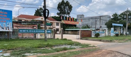
1. Geographic location:

Long Tan commune is located in the north of the
administrative center of Nhon Trach district, and Long Tan’s center is
approximately 3 km from the district’s center, around 35 km from Bien Hoa city
along National Highway 51 and Provincial Road 25A also known as DT 769, which is
now Ly Thai To street.
- Long Tan borders on district 9 of Ho Chi Minh city
across from Dong Nai river to the north.
- Long Tan borders on the administrative center of
Nhon Trach district, Dong Nai province to the south.
- Long Tan borders on Phu Hoi and Phuoc Thien
communes in Nhon Trach district, Dong Nai province to the east.
- Long Tan borders on Phu Thanh, Dai Phuoc, and Vinh
Thanh communes in Nhon Trach district, Dong Nai province to the west.
2. Natural land area:
- Long Tan’s total natural area is 3,546.88 ha and
it has a total population of 2,825 households in 2019 and 11,186 people. Long
Tan is divided into 3 hamlets: Long Hieu, Vinh Tuy and Binh Phu.
3. Administrative unit:
- Long Tan has 1 cultural center; 3 hamlet cultural
houses; 1 medical station that is recognized to meet national standards; 4
schools including secondary school, 1 primary school, 1 preschool, 1
kindergarten; and 3 out of 4 schools are recognized to be national schools.
4. Terrain:
Long Tan has a terrain type and its terrain is not
flat with 50% of high hills, 50% of plain, and a system of interlaced rivers and
canals.
5. Climate:
Long Tan is located in a monsoon climate with two
seasons.
Humidity:
- Average temperature: 26 Celsius degrees.
- Highest temperature: 29 Celsius degrees.
- Lowest temperature: 24 Celsius degrees.
6. Population:
Total population: 11,186 people.
Total number of households: 2,825.
Ethnic groups: Kinh, Khmer, Tay, Chinese Vietnamese.
Religions: Caodaism, Buddhism, Catholicism, and
Protestantism.